A New Lens on the Past
For decades, Machu Picchu has been one of the most studied archaeological sites in the world. Yet, the mountain citadel still holds secrets locked away beneath the thick canopy of the Peruvian cloud forest. Now, a collaborative project between Peru’s Decentralized Directorate of Culture (DDC) in Cusco and the Center of Andean Studies at the University of Warsaw has utilized LiDAR (Light Detection and Ranging) to peel back the layers of time, revealing more than 2.5 kilometers of hidden Inca roads, platforms, and terraces.

How LiDAR Pierces the Canopy
Traditional excavation in the Andes is a monumental challenge. The terrain is often steep, and the dense vegetation hides architectural remnants from even the most observant explorers. LiDAR changes the game by firing rapid laser pulses at the ground, measuring the reflected signals to build high-precision, 3D models of the terrain. This allows researchers to digitally 'strip away' the vegetation to reveal foundations, roads, and man-made structures that remain invisible to the naked eye.
- 2.5+ kilometers of previously unknown Inca paths discovered.
- Collaboration between the University of Warsaw and the DDC of Cusco.
- Technological advantage in navigating extreme, mountainous landscapes.
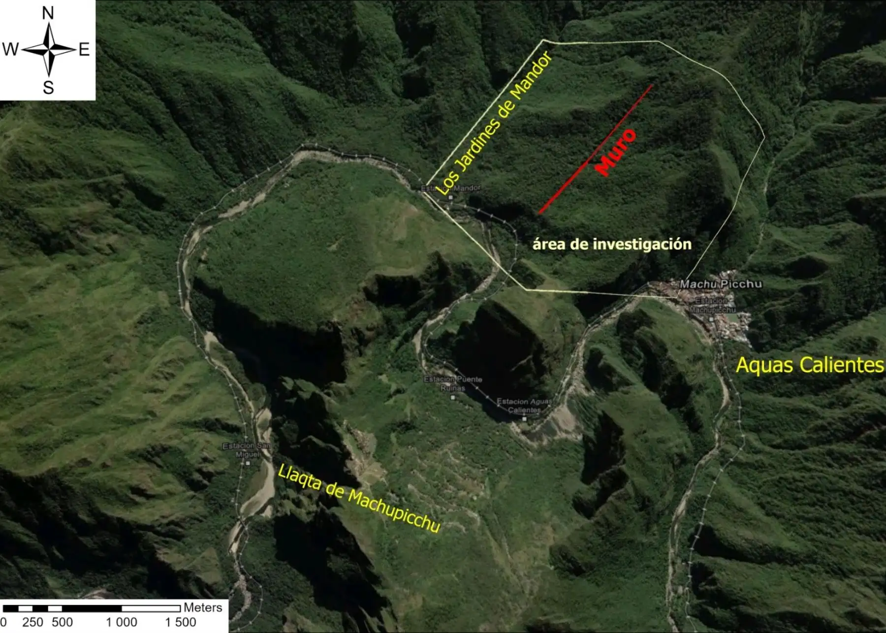
- Discovery centered on the Muralla de Mandor sector.
Implications for Future Discovery
Maritza Rosa Candia, executive director of the DDC Cusco, highlighted that this technology is not just about finding new paths; it is about better targeting future conservation and research efforts. By mapping the layout of the broader landscape, experts can better understand how the Inca managed, traversed, and lived in the mountainous regions surrounding the citadel.
The discovery could provide important new evidence about how people moved through the mountainous territory surrounding the famous citadel before the Spanish conquest.
— HeritageDaily
While these findings are significant, experts caution that this is not an invitation for new tourism routes. The site requires careful investigation and conservation before any potential public access could be considered. Furthermore, the data gathered is being used to train neural networks, potentially creating a global toolkit for archaeologists to identify similar ancient features in other parts of the world.